

Several posts ago I wrote about the Horizon 2020 projects, and today I will continue this topic explaining some characteristics of the DIANA project.
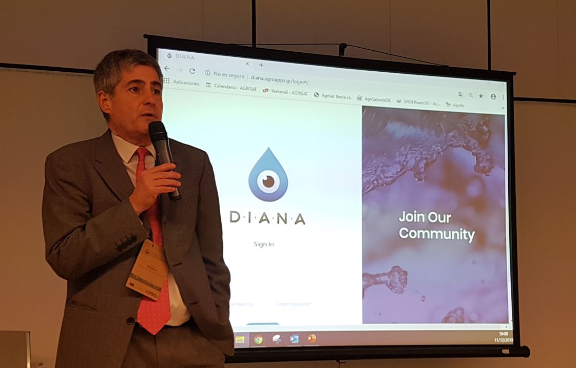
In the middle of last December, the (#EUWIC) EU Water Innovation Conference 2019 was held in Zaragoza: Accelerating action to tackle water pollution and enhance EU preparedness to water-related climate change impacts. That week I had things scheduled and I could not follow all the presentations, but I could attend the closing of the DIANA Project, who had personally invited me days in advance.
1. Characteristics of the DIANA Project
In European projects it is important to define the title of the project, its acronym and its corporate image. The acronym DIANA summarizes the project (Detection and Integrated Assessment of Non-authorized water Abstractions using EO: Integrated detection and evaluation of unauthorized water withdrawals using Earth Observation).
In the following table are the main characteristics of the DIANA Project. This table collects the information of the variables collected from all Horizon 2020 projects.
This is a project with a total budget of 2.4 M euros and a duration of 3 years.
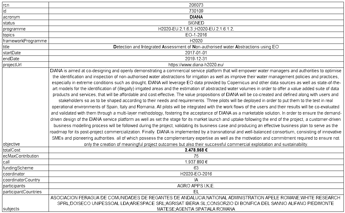
Another of the variables collected is the end date of the project (December 31, 2019) and the start date (January 1, 2017).
I want to value the start date of the project. The launch of the European Sentinel 2A satellite was in June 2015, and the Sentinel 2B in March 2017. At present, much progress has been made in observing the Earth using satellites, but the situation at the time the project began was very different. Therefore, it should be noted that a Horizon 2020 project was proposed 4 years ago to improve water management in agriculture through satellite images.
2. The General Water Directorate in the DIANA project.
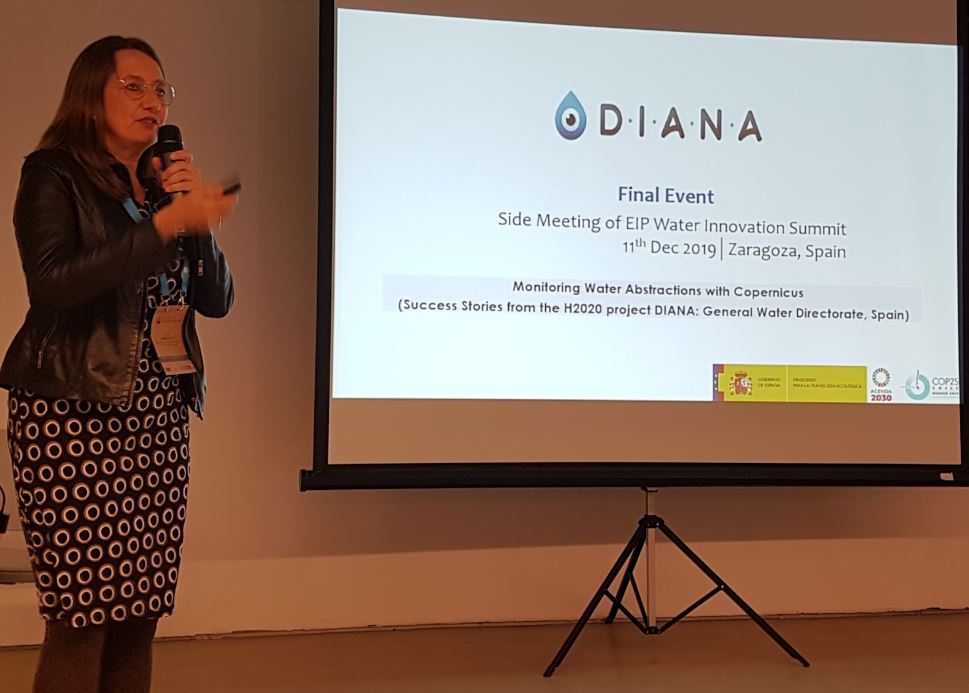
The presentation of the DIANA Project in the EUWIC was attended by two people from the General Water Directorate of the Ministry of Ecological Transition, Mr. Manuel Menéndez, General Director, and Mrs. Conchita Marcuello.
The Director General of Water shared a few words at the opening of the act, in which he explained that currently there is technology available for the evaluation of water resources, but the demand estimate fails.
It is true that there are counters, but they are not everywhere, and in some places the readings do not correspond to reality because Magnet Kits are sold to trick the flow meters. In the past we worked with perimeters of irrigation and average endowments. With the advances in remote sensing, updated information on each plot is within our reach.
The head of the General Water Directorate confirmed that there is a real interest of water resources managers in improving knowledge of water demands through information from European satellites.
Mrs. Conchita Marcuello was in charge of the Water DG and gave a presentation. She began by explaining that one of the functions of the General Water Directorate is the coordination of all the hydrological plans carried out by the different Hydrographic Confederations. From this direction, a forum has been held to evaluate how remote sensing techniques can help in hydrological planning.
She then commented on the distribution of the Agrarian surface of Spain, and where irrigation is located, which represents 15% of the Useful Agricultural Area. Of the 33,000 hm3 available, globally, 72% corresponds to irrigation water.
In Planning, work is done at the UDA level (Agricultural Demand Unit) and one of the pending tasks is to update the consumptions that exist for the current climatic conditions.
She reviewed the different pilot areas, as well as the experience of contrasting the values obtained with remote sensing with the values obtained with 2.500 ha flow meters from the Júcar Hydrographic Confederation.
In the conclusions, she stressed that one of the next steps to be carried out is to use remote sensing to estimate the water demand of the crops, to incorporate it into the balance of the River Basin Management Plans (RBMP).
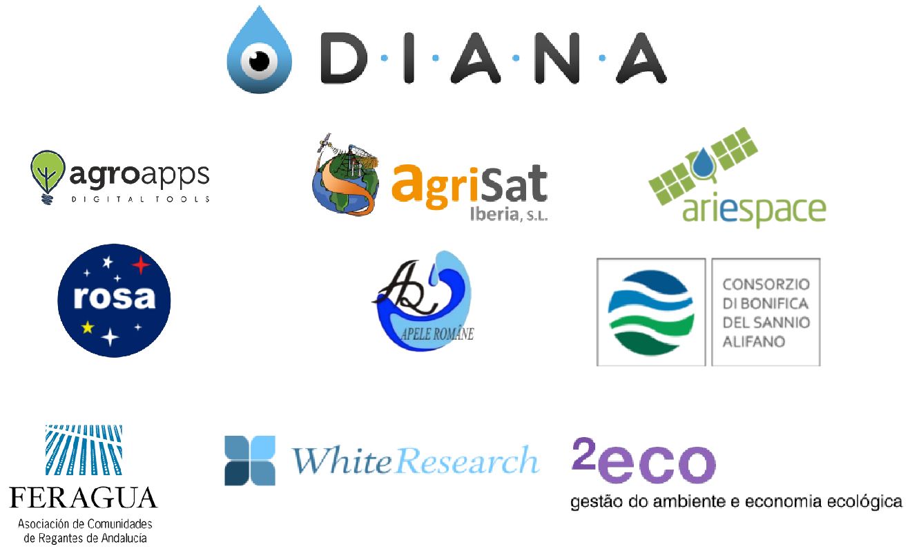
3. Partners of the Diana project.
As is common in European projects, there are a significant number of partners, and these are distributed by different countries of the European Union.
- Agro apps (Greece).
- AgriSat (Spain).
- Rosa (Romania).
- Ariespace (Italy).
- Narw (Romania).
- Consorzio di Bonifica del Sannio Alifano (Italy).
- Feragua (Federación Andaluza de Comunidades de Regantes de Andalucía) (Spain)
- White Research (Belgium).
- 2eco (Portugal).
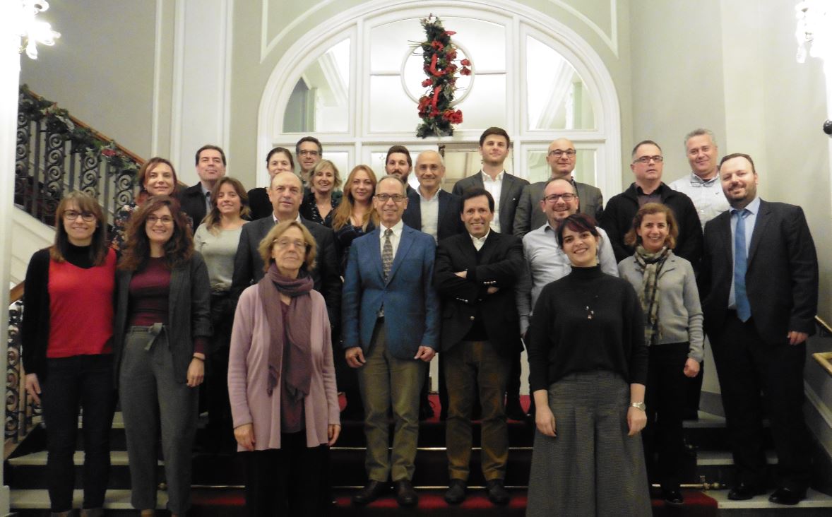
In the following photo are those responsible for the project of the different partners, who attended the final meeting of the project.
4. Pilot areas of the DIANA Project.
The location of the different Pilot Areas of the DIANA Project is represented in the following figure, the main characteristics of each of these projects are shown in the table.
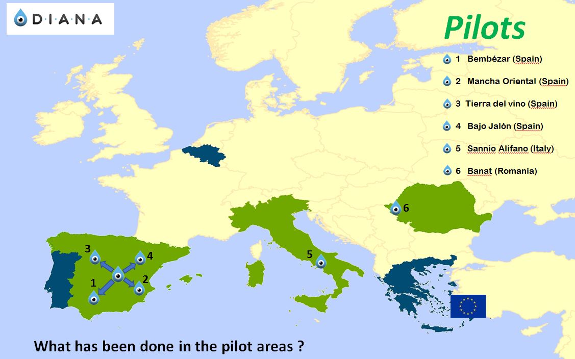
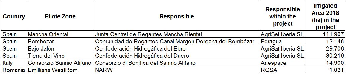
Table. 2. Characteristics of the different pilot projects. In the pilot area of Romania, the pilot was a part of the irrigable zone.
5. Achievements of the DIANA project
The objectives set by the DIANA project were the identification of illegal water extractions, as well as the monitoring of the evolution of water demands to identify those excessive demands for irrigation water.
The process of identifying excessive demands could be summarized in:
- Annual process of declaration of crops to the Community.
- Introduction of information in a GIS.
- Control in the field of the declared information.
- Monitoring of water demand.
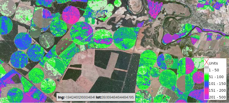
The following figure expresses in a very graphic way how the use of remote sensing has served to significantly reduce in recent years the area affected and the excesses sanctioned by the irrigation jury. It has gone from excesses of 7 hm3 in 2001, to values lower than 0.1 hm3 in recent years.

6. Post DIANA products.
Another of the objectives of the European Projects is that there is a continuity of the projects carried out. At the end of the DIANA project, a couple of platforms have been developed to commercialize demand management services through satellite information. In Spain the name Hydrogestor will be used and in Italy the name Irrisat.
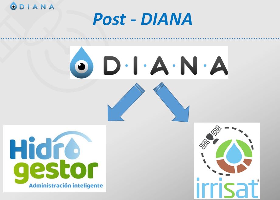
Fig. 10. Commercial products post DIANA.