
The Arctic ocean are often not included in the global sea level estimation. This is partly due to seasonal changes in the sea-ice cover and insufficient satellite coverage. But a new study now provides this overview by looking at extensive amounts of data volumes over many years.
In a collaborative effort, researchers from the Technical University of Denmark (DTU) and from the TUM have now documented sea-level changes in the Arctic over a 22-year period. By analyzing data for the period between 1996 and 2018 the research team have revealed the long-term trend: The Arctic sea level rose by an average of 2.2 millimeters per year.
The new results have been published in the scientific journal Remote Sensing.
“Our study is based on altitude measurements from space via altimetry satellites and covers the period from 1991 to 2018. Thus, we have obtained the most complete and precise overview of the sea level changes in the Arctic ocean to date. This new information is important in terms of being able to estimate future sea levels associated with climate change,” said Stine Kildegaard Rose, Ph.D. at DTU Space, The National Space Institute in Denmark, and first author to the article in Remote Sensing.
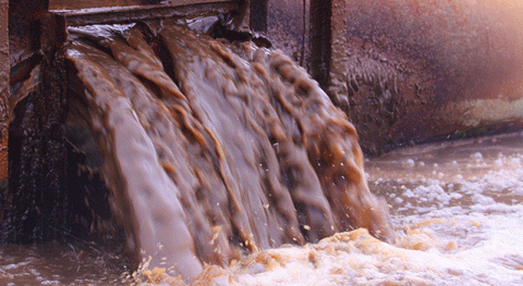
The enormous volumes of fresh water released in the Arctic not only raise the sea level, they also have the potential to change the system of global ocean currents and thus the Earth’s climate.
“The Arctic is a hotspot of climate change,” said professor Florian Seitz of the German Geodetic Research Institute at the Technical University of Munich (TUM).
“Due to rising temperatures, the glaciers of Greenland are receding. At the same time sea ice is melting. Every year, billions of liters of meltwater are released into the ocean.”
Finding water with algorithms
The researchers at TUM has developed algorithms to evaluate radar echoes reflected from the water where it reaches the surface through cracks in the ice.
"This new information is important in terms of being able to estimate future sea levels associated with climate change". Stine Kildegaard Rose, Ph.D. at DTU Space
“The challenge lies in finding the water signals in the measured data. Radar satellites measure only the distance to the surface, but vast areas of the Arctic are covered with ice, which obscures the seawater,” explains Dr. Marcello Passaro who also contributed to the new study.
Using the algorithms, Passaro processed and homogenized 1.5 billion radar measurements from the ERS-2 and Envisat satellites. On the basis of the signals tracked at the TUM, the DTU team worked on the post-processing of these data and added the measurements collected by the current CryoSat radar satellite mission.
Uneven distribution of sea level changes
Even though the data shows an average sea level rise of 2.2 millimeters per year there are significant regional differences.
Within the Beaufort Gyre area, north of Greenland, Canada and Alaska, sea levels rose twice as fast as on average corresponding to more than 100 millimeters in 22 years. The reason is that the low-salinity meltwater collects here, while a steady east wind produces currents that prevent the meltwater from mixing with other ocean currents.
Along the coast of Greenland, on the other hand, the sea level is falling. On the west coast by more than 5 mm per year. This happens because the melting glaciers weaken the attractive force of gravity there.
“The homogenized and processed measurements will allow climate researchers and oceanographers to review and improve their models in the future,” said Marcello Passaro.