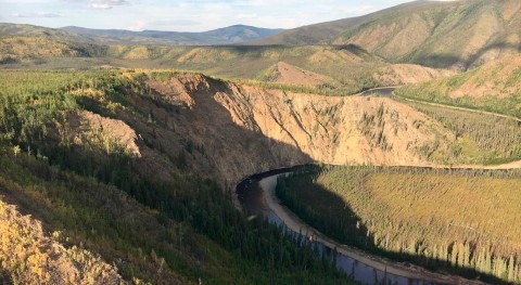
Wetlands, floodplains and aquatic habitats are some of Utah’s most important ecosystems. They are home to many bird, plant and fish species, and they provide unique outdoor recreation opportunities.
But in recent years these habitats have faced mounting pressure from encroaching land use and increased demand for water. Now researchers at Utah State University are developing new tools that help preserve and increase the area and quality of wetland, floodplain and aquatic habitats.
USU Associate Professor David Rosenberg and Ayman Alafifi, a water resources engineer at Brown and Caldwell, have developed an innovative computer model that helps water and wetland managers make better, data-based decisions. Their work was recently published in the journal, Environmental Modelling and Software. The study is part of a multi-year research effort focused on creating more effective habitat management tools.
The Watershed Area of Suitable Habitat systems model, known as WASH, takes hydrologic, topography, ecological and management data and helps managers identify when, where and how to allocate water, financial resources and vegetation management to improve the area and quality of the three habitat types. Recommendations are subject to constraints, including water availability, vegetation growth, infrastructure and existing demands.
“It’s important to manage water and vegetation together in these areas,” said Rosenberg. “Managing water and vegetation together helps us identify synergies and trade-offs across the three habitat types.”
Rosenberg and Alafifi recently tested the model along the lower Bear River in Northern Utah, the largest source of water to the Great Salt Lake. The results show potential to increase aquatic habitat area during all months of the year, an increase in floodplain habitat during spring and summer, and an increase in wetland habitat during critical summer months when water is most scarce.
“These habitats and their well-being affect many residents in Utah because Utahns like to fish, hunt, bird and recreate,” said Rosenberg. “People value these outdoor areas and want to see them improved.”


