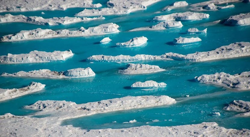
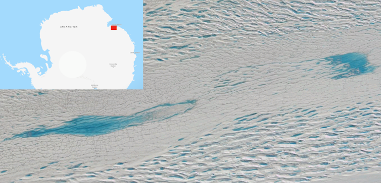
During the Antarctic summer, thousands of mesmerising blue lakes form around the edges of the continent’s ice sheet, as warmer temperatures cause snow and ice to melt and collect into depressions on the surface. Colleagues of mine at Durham University have recently used satellites to record more than 65,000 of these lakes.
Though seasonal meltwater lakes have formed on the continent for decades, lakes had not been recorded before in such great numbers across coastal areas of East Antarctica. This means parts of the world’s largest ice sheet may be more vulnerable to a warming climate than previously thought.
Lakes affect ice shelves
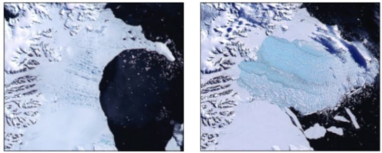
Much of Antarctica is surrounded by floating platforms of ice, often as tall as a skyscraper. These are “ice shelves”. And when some of these ice shelves have collapsed in the past, satellites have recorded networks of lakes growing and then abruptly disappearing shortly beforehand. For instance, several hundred lakes disappeared in the weeks before the the catastrophic disintegration of the Larsen B Ice Shelf – when 3,250 km² of ice broke up in just two months in 2002.
The collapse may have depended on water from these lakes filling crevasses and then acting like a wedge as the weight of the water expanded the crevasses, triggering a network of fractures. The weight of lakes can also cause the ice shelf surface to flex, leading to further fracturing, which is thought to have helped the shelf become unstable and collapse.
Ice shelves act as door stops, supporting the huge mass of ice further inland. Their removal means the glaciers feeding the ice shelf are no longer held back and flow faster into the ocean, contributing to sea-level rise.
Melting the ice sheet surface
Scientists already knew that lakes form on the Antarctic ice sheet. But the latest study, published in Scientific Reports, shows that many more lakes are forming than previously thought, including in new parts of the ice sheet and much further inland and at higher elevations.
Since the cold and remoteness makes it logistically challenging to measure and monitor Antarctica’s lakes in the field, we largely know all this thanks to satellite imagery. In this case, one of the satellites used was the European Space Agency’s Sentinel-2 which provides global coverage of the Earth’s surface every five days and can detect features as small as ten metres.
My colleagues analysed satellite images of the East Antarctic Ice Sheet taken in January 2017. In total, the images covered 5,000,000 km² (that’s more than 20 times the area of the United Kingdom).
Because water reflects certain wavelengths very strongly compared to ice, lakes can be detected in these images by classifying pixels in the image as “water” or “non-water”. From these images we can pinpoint when lakes form, their growth and drainage, and how their extent and depth change over time. The largest lake detected so far was nearly 30 km long and estimated to hold enough water to fill 40,000 Olympic-sized swimming pools.
Cause for concern?
In a warming world, scientists are particularly interested in these lakes because they may contribute to destabilising the ice shelves and ice sheet in future.
Like a sponge, the more that ice shelves become saturated with meltwater, the less they are able to absorb, meaning more water pools on their surfaces as lakes. More surface lakes mean a greater likelihood that water will drain out, fill crevasses and potentially trigger flexing and fracturing. If this were to occur, other ice shelves around Antarctica may start to disintegrate like Larsen B. Glaciers with floating ice tongues protruding into the ocean may also be vulnerable.
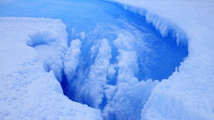
Meanwhile in Greenland, scientists have observed entire lakes draining away within a matter of days, as meltwater plunges through vertical shafts in the ice sheet known as “moulins”. A warm, wet base lubricated by meltwater allows the ice to slide quicker and flow faster into the ocean.
Could something similar be happening in Antarctica? Lakes disappearing in satellite imagery suggests they could be draining in this way, but scientists have yet to observe this directly. If we are to understand how much ice the continent could lose, and how much it could contribute to global sea-level rise, we must understand how these surface meltwater lakes behave. Though captivating, they are potentially a warning sign of future instability in Antarctica.

![]()
Jennifer Arthur, PhD student, Cryospheric Remote Sensing, Durham University
This article is republished from The Conversation under a Creative Commons license. Read the original article.


