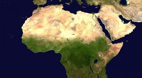
As expanding populations and increasing climate change demand more efficient use of water in producing food, reliable data for monitoring crop productivity have become crucial. As part of an international initiative to address this in the Near East and Northern Africa (NENA) region, IHE Delft, in cooperation with eLEAF and Nieuwland Geo-information, is providing specialist training for Ministry staff in the beneficiary countries of SIDA (the Swedish International Development Cooperation Agency). The goal of the training is to promote crucial expertise in crop mapping using remote sensing (RS) data.
Building on a successful pilot in Tunisia that spanned from April to September last year, IHE Delft, eLEAF and Nieuwland Geo-Information, together with SIDA and the UN’s Food and Agriculture Organisation (FAO), implemented a similar training for the NENA countries. In the final module, taking place in Jordan for three days this week (22 to 24 October), the participants will present their results. The training is part of the FAO/SIDA objective of “Implementing the 2030 Agenda on Water Efficiency, Productivity and Sustainability in the NENA Countries”.
Crucially, the RS training, designed to equip experienced ministry staff and agricultural engineers with the skills to produce consistent and unbiased crop production estimates, relies exclusively on Open Data and Open Source Software. This eradicates the need for expensive commercial software, and provides water managers with the knowledge and skills to find, access and generate publicly available data. For many professionals this is still unknown territory, as IHE Delft lecturer, Hans van der Kwast, discusses in his recent video and latest blog on using Open Source Software in the agriculture and water sector.
Given the slowness in developing licensed products, and the costs associated with using them, Hans is keen, both to demonstrate the benefits of Open Source, and to help students and professionals to navigate the Open Data world.
“As a lecturer I try to motivate students and researchers to become active in the open source community, to meet the developers and to contribute with their knowledge to further development. The QGIS community organizes so-called hackfests or hackathons. These are inspiring meetings where users and developers come together to improve the software.”
To help further in this endeavour, Hans will be using income from his recent book, QGIS for Hydrological Applications, to support students in attending QGIS meetings, and to increase the diversity of the QGIS community.


