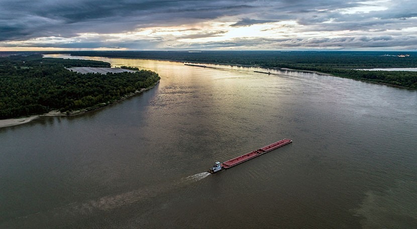
Flows in the Mississippi River are so low that saltwater from the Gulf of Mexico is moving upstream farther than usual, raising concerns since the river is a source for municipal and industrial water supply, informs Associated Press.
The intrusion of saltwater upstream the Mississippi River is a naturally occurring periodic condition, when the river flows decrease below a certain level. In a typical year, most of the months the water flow of the Mississippi River is enough to prevent saltwater from intruding upstream above Head of Passes, considered the location of the river mouth, where its main stem branches off in three directions.
The U.S. Army Corps of Engineers plans to build an underwater barrier, a sand sill rising up to 45 feet (15 metres) above the bottom of the river to artificially stop the saltwater wedge. The project is expected to cost $10 million and will be finished in early November. The sill has so far been constructed three times, in 1988, 1999, and 2012; it will prevent saltwater from reaching two of the water treatment plants in Plaquemines Parish, to the south of New Orleans, and further upstream. When the flows in the river recover, the current is expected to push back the saltwater and wash away the sill.
Last week Plaquemines Parish issued a Drinking Water Advisory warning about high levels of sodium and chloride in the drinking water, which can be a problem for people with certain health conditions (on dialysis and/or on low-sodium diets). Also, chloride could affect the taste, odour and colour of drinking water. Two of the treatment plants in the area are downstream of the planned sill, and will be fitted with reverse-osmosis equipment to remove the salt from the water.
The low flows are caused by drought in the Mississippi drainage basin, which includes about 40% of the continental United States. In addition to low water flows, the Corps recently increased the navigation channel depth of this major commercial waterway from 45 to 50 feet, causing an increase in the duration and extent of saltwater intrusion. The area where the sill will be built is about 90 to 95 foot deep, so the sill, to be built in five-foot increments until it effectively blocks the saltwater wedge, could decrease the depth to the point that the largest vessels might have some restrictions to get through.
The low flows in the Mississippi River have already impacted barge traffic at points between St. Louis and New Orleans. This happens at a bad time, since crops recently harvested are ready to be transported using the waterway. Most of the Mississippi River basin has seen below-normal rainfall over the past 30 days, according to the National Weather Service. The portion of the basin south of St. Louis has been mostly dry for the past three months, and the hot and dry conditions are expected to continue.


