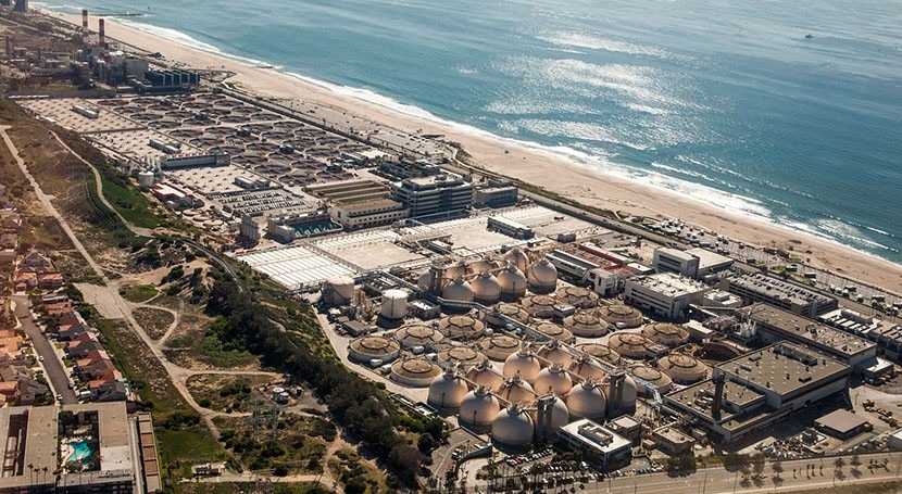
As sea levels rise in California, beachfront homes are not all that’s at risk of flooding. Many industrial sites are also located in coastal areas.
“There are refineries, sewage treatment plants, power plants, legacy hazardous waste sites, Superfund sites, cleanup sites,” says Lara Cushing of the Fielding School of Public Health at the University of California, Los Angeles.
She says if these industrial sites flood, hazardous pollutants could be released into nearby communities.
So she’s working on the Toxic Tides project, an effort by researchers and community partners to quantify the risks and raise awareness about the issue.
The group has created online maps that show where hazardous facilities are located in California and how likely each is to flood this century under a worst-case climate scenario.
The maps also provide census data about the people who live near the most flood-prone sites.
“You’ll see higher rates of poverty, a higher proportion of residents identifying as people of color,” Cushing says. So the maps also highlight environmental injustice. By sharing data, the team hopes to help state and local leaders protect vulnerable coastal residents from hazardous waste.


