In modern urban water infrastructure management, traditional operational models based on rectifying problems after they have occurred have become obsolete. It is no longer acceptable, either economically or environmentally, to wait until a sewer has physically collapsed, a sinkhole has appeared on a public road, or an unexpected overflow has occurred during torrential rain before taking action.
The operational efficiency of operators today is measured strictly by their ability to predict asset behaviour, plan long-term investments and act proactively in the face of anomalies before they reach a point of no return.
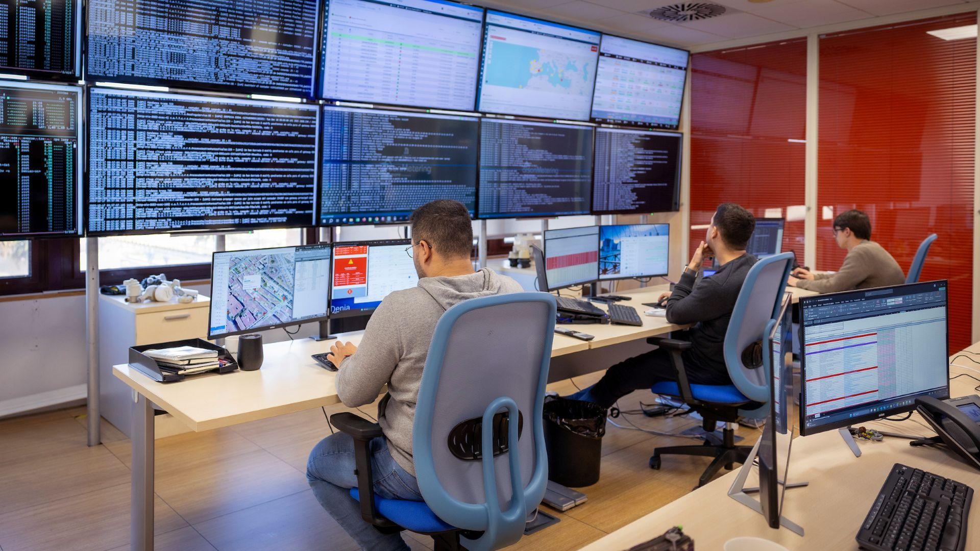
This profound sectoral transformation towards true predictive maintenance is underpinned by a three-dimensional technological infrastructure: Geographic Information Systems (GIS), Computerised Maintenance Management System (CMMS) platforms, and advanced Artificial Intelligence (AI) algorithms integrated with closed-circuit television (CCTV) inspection systems. ACCIONA, as a leading pioneer in the digitalisation of the full water cycle, has succeeded in integrating these technologies into a unique automated ecosystem, eliminating traditional information silos and ensuring comprehensive, rapid and reliable infrastructure management.
In ACCIONA's model, GIS has evolved from being a mere cartographic repository or static digital map into a dynamic relational database
GIS: the dynamic asset inventory
In ACCIONA's model, GIS has evolved from being a mere cartographic repository or static digital map into a dynamic relational database, directly linked to day-to-day field operations and subject to continuous updates of the inventory, its characteristics and its status. At the heart of this system is the robust asset inventory, conceived as the "Data Source" for strategic decision making.
An optimised inventory within the GIS environment delivers value across three critical dimensions:
- Operational Accuracy. Enables the georeferencing and location of physical assets.
- Advanced Modelling and Predictive Analysis. By cross referencing spatial data with tabular variables, GIS moves beyond a purely descriptive role to become a predictive analysis tool, enabling the modelling of vulnerability scenarios and the identification of specific sections with a higher mathematical probability of suffering breaks or losses of hydraulic capacity.
- Attribute Integrity and Business Intelligence. A geometric feature on the map is of little value if it is not linked to a rich alphanumeric matrix. Detailed tabular information, including materials, installation dates, linings, rehabilitation and operational histories, structural condition, and other attributes, transforms a simple graphical vector into an intelligent feature capable of reporting on its own life cycle.
CMMS (GOTA): the engine that transforms data into operational action
For geospatial and predictive intelligence to translate into tangible improvements on the ground, a robust Computerised Maintenance Management System (CMMS) is essential. Within ACCIONA's digital ecosystem, this central role is fulfilled by the GOTA (Acciona Work Order Management) system. GOTA acts as the fundamental logistical bridge and the two-way operational link connecting the analytical requirements of the technical office with the mobile terminals of the teams operating on public roads, directly coordinating human and material resources in real time.

The GOTA platform integrates natively with the most advanced digital inspection systems so that field units receive the Work Order (WO) and the assets to be inspected automatically. This close integration of systems eliminates the need to re-enter data manually or rely on printed document workflows, significantly accelerating on-site operations and ensuring the absolute integrity of the information. GOTA ensures that no network asset is left unmanaged and that every detected anomaly is duly recorded, assigned and resolved under strict traceability controls.
The advanced CCTV inspection process
To provide this digital brain with accurate information, it is vital to equip the organisation with high-precision diagnostic tools for use inside the pipes. Inspection using robotic CCTV systems, drones and robotic inspection units represents the most advanced methodology for assessing the internal condition of sewers without the need for open-cut works. The primary objective of these campaigns extends far beyond video capture, focusing instead on the systematic extraction of structured data to calculate the actual probability of failure for each section of the infrastructure.
The field inspection process is carried out according to a strict technical procedure:
- Inspection using Robotic Units: Robots equipped with adaptive traction to overcome sediment, high-resolution cameras and advanced geometric sensors are inserted into the sewers. These devices travel through the sewers, recording video in real time.
- Laser Profiling Systems: The most advanced equipment incorporates a laser ring that projects a precise geometric pattern onto the inner walls of the pipe. This enables the oval deformations suffered by flexible or semi-rigid pipes due to mechanical overloads from the ground or surface traffic to be measured with millimetre precision, detecting structural faults invisible to the naked eye.
- Standardised Coding under European Standards: To eliminate subjectivity in diagnoses, observations are structured in accordance with international standards. Each finding is rigorously classified into two main categories:
- Structural Defects: Longitudinal and circular cracks, breaks, displaced joints, vault collapses, or corrosion caused by hydrogen sulphide.
- Functional Defects: Intrusion of tree roots, accumulation of consolidated sediments, encrustations, severe obstructions or large deposits of grease and oil.
- Numerical Condition Rating: Linked to the coding system, each type of defect is assigned a numerical value based on its severity and extent. Upon completion of the section analysis, the software algorithmically processes the penalties to assign a standardised Condition Rating on a scale of 1 to 5, accurately determining the level of degradation of the sewer.

Field logistics: the transition from data to action
GOTA ensures that no network asset is left unmanaged and that every detected anomaly is duly recorded, assigned and resolved
Using network behaviour management and analysis tools, GOTA issues a digital Work Order (WO). The operator receives a project on their vehicle's field computer containing the sequential route and the technical data sheets for the assets to be inspected. Thanks to native recording tools and their geographical modules, GIS layers are displayed directly on the operator's control console, integrating the graphical inventory with the work order. The technician no longer has to manually enter infrastructure information. Subsequently, the automated system directly links each video file and inspection database to the unique ID of the asset in the inventory, safeguarding the integrity of the information and eliminating errors caused by manual transcription.
The artificial intelligence revolution: computer vision and automated efficiency
Once the data has been collected and the assets in the assigned area inspected, artificial intelligence (AI) comes into play, natively integrated into ACCIONA's workflows. The incorporation of advanced deep learning and computer vision models radically transforms a process that historically depended on a technician's visual skills and subjective interpretation into a discipline of massive, standardised and strictly objective data analysis.
The competitive and performance advantages that AI brings to this workflow are disruptive for three fundamental reasons:
- Automated Detection: Computer vision algorithms analyse images frame by frame, instantly identifying defects such as cracks, blockages and roots without the operator having to constantly stop the equipment.
- Neutralisation of Fatigue and Human Error: Continuously viewing hours of footage from dark pipelines causes cognitive fatigue in operators. AI maintains a consistent hit rate and absolute precision throughout the working day.
- Absolute Standardisation of Criteria: Ensures the technical consistency of diagnoses on a global scale. A specific defect will be coded with the same severity and under the same standards regardless of whether the inspection is carried out in one geographical area or another, eliminating discrepancies in criteria between different operators or inspection technicians.

In addition to real-time analysis, AI is revolutionising post-processing in the technical office. Traditionally, drafting technical reports, selecting screenshots of defects and converting observations into regulatory codes took as long as, or even longer than, the physical inspection itself on site. With the self-coding systems implemented by ACCIONA, AI interprets visual findings and translates them directly into the character strings required by regulations, instantly populating data tables and reducing office processing times.
Automated data flow and feedback to the GIS
True technological excellence ensures that engineering data flows automatically, transparently, guaranteeing full traceability
True technological and operational excellence does not lie in the flashy use of robots or isolated algorithms, but in ensuring that engineering data flows automatically, transparently and without manual intervention between all operational and management tools, guaranteeing full traceability. This integrated flow ensures that the cartographic inventory remains a living entity, a faithful reflection of the physical reality underground.
Once the fieldwork has been completed and the AI analysis has been passed, the project is uploaded to ACCIONA's central system, which consolidates the information and automatically generates high-resolution digital technical reports for each section:
- Analytical Longitudinal Defect Profile: A continuous engineering graph that linearly represents the pipeline's route, pinpointing the exact metre and centimetre location of each detected anomaly.
- Linked Photographic Captures: Clear visual evidence captured automatically by the software at the precise moment the defect is detected, integrated directly as graphic appendices in the technical report.
- Calculation of Structural and Hydraulic Condition Indices: Weighting algorithms that assess the density and severity of defects to issue a final rating of the asset's condition.
- Indexed and Cloud-Linked Video: High-definition video files are stored on cloud servers and are permanently indexed to the collector's alphanumeric record in the GIS.
The final synchronisation with the central database updates critical attribute fields such as the Date of Last Inspection, Condition Rating and other asset attributes via automated database files for each work area. The most important aspect of this methodology, designed by ACCIONA, is the predefined coding that enables PDF files and alphanumeric data to be linked bidirectionally between the CCTV, CMMS and GIS environments.

From this point onwards, the automated business intelligence workflow operates autonomously based on the asset's Condition Rating:
- If the Condition is Critical (Ratings 4 or 5), GOTA automatically generates a repair request or a new Work Order for the engineering department so that the refurbishment or replacement project can begin.
- If the Condition indicates a high sediment density, the system schedules an automated preventive cleaning task for the operational calendar.
- If the Condition is Optimal (Ratings 1 or 2), the system updates the date of the next routine predictive inspection.
This entire circular process is fully recorded and documented in the asset's lifecycle history, enabling the GOTA platform to ensure that no defect identified by the technology goes unaddressed.
Leading the digital transformation of the water cycle
ACCIONA’S leadership lies in its strategic vision to combine high-precision water engineering with Industry 4.0 technological solutions
These advanced, automated digital ecosystems that integrate GIS, CMMS (GOTA), inspection robots and AI are not a theoretical exercise or a futuristic science fiction scenario. They represent an established operational reality that is already increasing the resilience, sustainability and efficiency of water infrastructure in complex urban environments.
In this demanding, competitive landscape, ACCIONA has positioned itself at the forefront of global water engineering. Its pioneering leadership lies not merely in the individual adoption of advanced IT tools, but in its strategic vision to combine high precision water engineering with Industry 4.0 technological solutions. The company has successfully demonstrated that the key to success lies not merely in capturing data, but in its comprehensive governance, enabling corporate and technical decision-making to shift from being purely reactive to proactive and predictive, thereby optimising all operational processes.
The ultimate goal is clear: to transparently transform sewerage networks into smart infrastructure, ensuring that underground network mapping becomes, more than ever, a living tool serving sustainability and urban efficiency in our cities.