
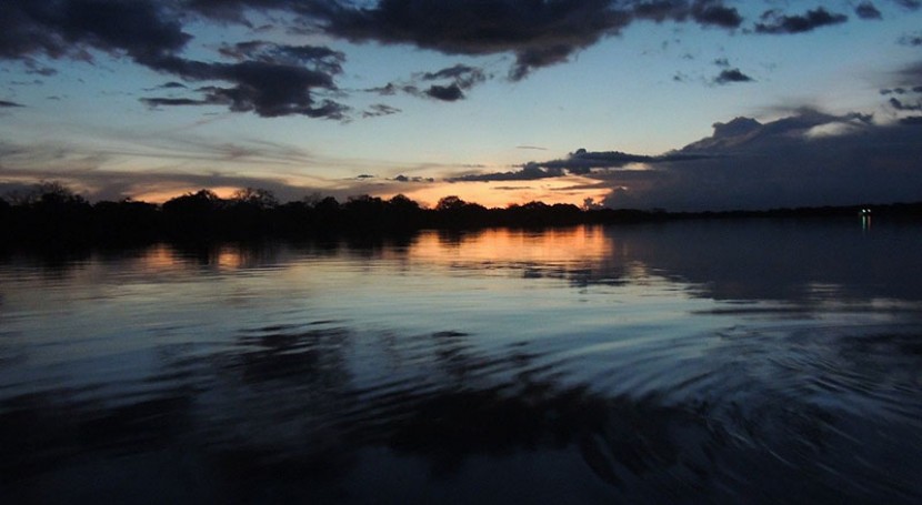
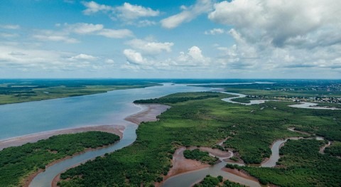
The Amazon basin is the world's largest river basin, with intricate and complex hydrology. It stretches across seven nations and feeds 4 of the 10 largest rivers in the world. The basin encompasses dense tropical forests, extensive floodplains, and interconnected wetlands. The region also receives a lot of rain—approximately 2,200 millimeters (86 inches) per year. Gaining a better understanding of Amazon hydrology is essential, especially in light of the ongoing environmental changes across the basin, with increasing floods, droughts, dam building, and deforestation.
Given the size and complexity of the ecosystem, scientists have used satellite technology to turn the Amazon into the world's premier remote sensing laboratory for hydrological and water cycle science. And more exciting science is on the horizon—over the next many years, NASA plans to launch two dedicated hydrology satellites: the Surface Water and Ocean Topography (SWOT) mission and the NASA-ISRO SAR (NISAR) mission.
In advance of the upcoming remote sensing missions, Fassoni-Andrade et al. recently published a comprehensive review of the basin's hydrology. An international team of more than 20 scientists compiled the study, which looks at three decades of work. The assessment evaluates precipitation, evapotranspiration, surface water, aquatic ecosystems, environmental changes, and more through the lens of remote sensing. The review provides a holistic view of the Amazon's water cycle while laying out challenges and knowledge gaps for future research in the region.
NASA plans to launch two dedicated hydrology satellites: the Surface Water and Ocean Topography (SWOT) mission and the NASA-ISRO SAR (NISAR) mission
The authors treat each topic as a sub review—for example, looking at precipitation, the authors discuss how infrared and microwave sensors monitor rainfall and describe the algorithms that process the data. They then report on successful remote sensing applications, such as how one project used satellite data to delineate the beginning and end of the Amazonian wet season. Last, the authors outline some challenges of measuring precipitation through remote sensing, including those related to the asymmetry of satellite readings and weather processes on the ground. They apply a similar structure to the other themes evaluated in the review.
According to the authors, their study serves as a model for other river basins to synthesize large-scale hydrological information. Although the knowledge reviewed in the paper needs to be translated to water management and environmental governance, the authors hope that the study will lead to an integrated monitoring and research agenda across the basin.


 to the modeling results without (dashed blue arrow) and with (solid blue arrow) groundwater mass redistribution. The model with groundwater mass redistribution is a much better match for the observed polar motion, telling the researchers the magnitude and direction of groundwater’s influence on the Earth’s spin. Credit: Seo et al. (2023), Geophysical Research Letters")
 inland of where the ice meets the ocean today, then re-advanced, according to new research published in AGU Advances. Scientists traced the ice’s movement using sediments from a lake more than 1 kilometer (0.6 miles) under the ice, sampled using the corer in this photo. Credit: Billy Collins")

