As climate change raises sea levels, estuarine cities are facing up to the dual threat of flooding and significant erosion. Research by a joint team from EPFL and the UNSW Sydney sheds new light on the hydrodynamic forces at play and paves the way for preventive strategies.
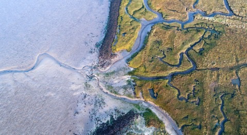
Almost 60% of the global population lives near an estuary, and the list of estuarine cities features 21 of the world’s 30 biggest urban centers, including New York and Tokyo. The mix of fresh and saltwater makes estuaries – some extending for hundreds of miles in length – diverse and complex ecosystems. They also serve important social and economic functions, from freight transport to recreation and fishing. Estuaries can be classified into two basic types, depending on whether the entrance is restricted (narrow) or unrestricted (wide). Variations in sediment accretion and water discharge can also cause entrance channels to change over time.
By the end of the century, global sea levels are expected to be higher than they are today. The predicted rise – anywhere between a few dozen centimeters and 2.5 meters or more – depends on how the pace of global greenhouse gas emissions slows, and on how fast the Antarctic and Greenland ice sheets melt. But in all scenarios, rising sea levels will significantly alter tidal hydrodynamics in estuaries. The effects of these changes could be felt inland – including in the cities that sit on their shores. Worst-case predictions point to flooding and increased coastal erosion.
In 2019, EPFL student Steve Hottinger explored this phenomenon as part of his Master’s project in environmental sciences and engineering. Since graduating, he has taken his work to the next level, teaming up with colleagues from the UNSW Sydney, Australia, to publish his findings in the prestigious Q1 journal Estuarine, Coastal and Shelf Science. Hottinger is named as one of the paper’s lead authors.
The team’s findings suggest that, for some cities, restricting estuary entrances will be necessary to avert disaster by 2100
Critical ratios
The researchers studied various phenomena – tidal amplification, deformation, reflection and resonance – to calculate the critical ratios between channel size and flood and coastal erosion risk. They observed a notable 20–60% reduction in tidal range if entrances are restricted by 80% when compared with unrestricted channels, and found that, although maximum tidal current velocity is higher in the restricted part of the channel, it is lower in the estuary part.
The team modeled 200 prismatic estuaries to assess their hydrodynamic response to sea level rises of between 0 and 2 meters, after adjusting for tidal forcing. They fed a number of parameters into the model, including flood velocity, width-to-length ratio, entrance restriction, tidal amplitude and current velocity, and water depth. For each estuary the model was run for 60 days, with the researchers taking thousands of measurements every 15 minutes to produce a rich dataset.
Averting disaster
The team’s findings suggest that, for some cities, restricting estuary entrances will be necessary to avert disaster by 2100. Their model could provide insights into where and what action is needed. “We can definitely see real-world uses for our model outside the lab,” says Giovanni De Cesare, the operational director of EPFL’s Hydraulic Constructions Platform, who supervised Hottinger’s Master’s project and is one of the paper’s co-authors.
De Cesare also envisages other practical applications of the model. “We could look into installing a tidal power station in an estuary to generate renewable electricity,” he suggests. “But we’d need to examine each case on its merits and consider the wider social and environmental implications.” The team is planning to run the model again, this time factoring in the impact of river flow rate.


