An innovative Natural Flood Management project based at the Brownlee Triathlon Centre in Leeds has been completed. The first of its kind in the country, it forms part of a catchment wide approach to installing NFM measures to reduce flood risk in the area and make it more resilient to the impacts of climate change.
The project has been delivered through a collaboration between the Environment Agency, Leeds City Council and the University of Leeds.
A range of NFM measures have been used to reduce flood risk by slowing the flow of water during periods of heavy rain, increasing resilience to the 1,048 homes, 474 businesses and key infrastructure that will be better protected by the scheme, as well as other communities along the River Aire.
Bodington fields, where the triathlon centre is situated, now offers a ‘living lab’ for teaching and researching at the University of Leeds and is a centre of excellence for natural flood management measures.
Adrian Gill, Area Flood Risk Manager at the Environment Agency, said:
"It’s great to see the finished product of the Natural Flood Management Programme at the Brownlee Triathlon Centre, an important component of the Leeds Flood Alleviation Scheme.
"As the country faces a national and global climate emergency, restoring our natural environment will also help us reach net zero emissions in the future."
Not only do natural flood management techniques help make Leeds more resilient to climate change and capture tonnes of carbon from the atmosphere, but they also enhance biodiversity and provide wider benefits for local wildlife.
We’re excited for visitors to see the work that has taken place at this new centre of excellence, and to learn more about how different natural solutions can be used to help reduce the risk of flooding along the River Aire.
Councillor Helen Hayden, Leeds City Council’s Executive Member for Infrastructure and Climate, said:
Many of us remember the devastating flooding on Boxing Day 2015, when the River Aire burst its banks and caused damage throughout Leeds. Flooding as recently as this February also serves as a stark reminder of why the Leeds Flood Alleviation Scheme Phase 2 is so vital to those who live and work in the area, now and in the future. The engineering works stretching from Leeds Train Station to Apperley Bridge are key to the resilience of the city, but just as integral is the catchment wide Natural Flood Management Programme.
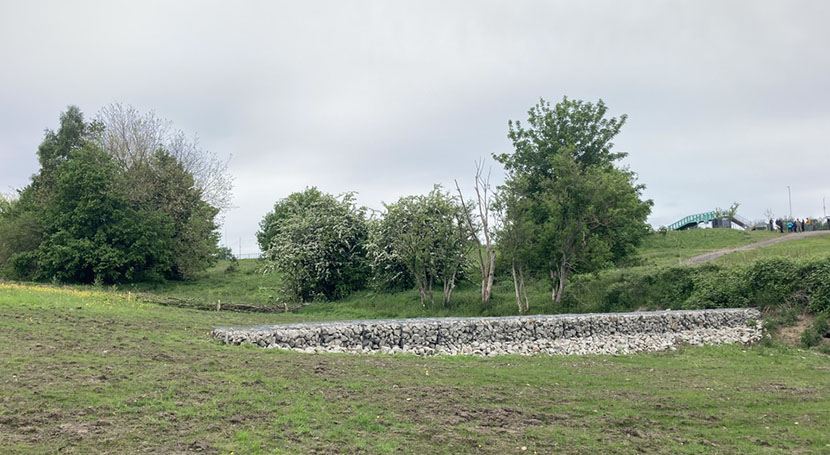
 Leaky wood debris dams and gabion walls
We all need to play our part in combating the climate emergency and the innovative NFM techniques trialled here will allow us to develop the gold standard of NFM and encourage wider use on both Leeds FAS2 and wider projects. The works will capture carbon, help us to reach our goals to combat the climate emergency, and create and preserve areas for wellbeing for our citizens and habitat for our wildlife.
Michael Howroyd, Sustainability Projects Officer at the University of Leeds, added:
"The site at Bodington Fields will be invaluable to academics and students, providing hands on research opportunities and data, whilst also providing benefits for local residents, biodiversity and climate.
"The project is a fantastic example of how collaboration across stakeholders can make use of University land as a living lab for world class research and teaching, which will have an impact across the wider city region and beyond."
Woodland and tree planting make up a proportion of the NFM measures used, including the planting of 5,000 trees. The trees help to not only to act as a shield to stop and slow rainfall before it reaches the ground, but they also increase carbon capture and storage capacity and provide valuable habitats for local wildlife.
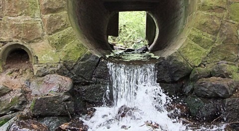
Among the other features installed are leaky wood dams and a balancing pond, which hold flood water during high rainfall to reduce the risk of flooding. Wetland scrapes and cross-track drains have also been created to store water away from more vulnerable areas, such as local drainage systems, that may otherwise overflow and cause flood damage.


